
Mt. Fuji, known locally as “Fuji-San”, stands 12,388 ft tall, and is the highest mountain in Japan. I was happy to get a photograph, but Delicia wanted us to climb it. She has fond memories of the excruciating climb as a teenager with her family and wanted to bestow that upon us.
Never-mind the fact that the month prior she had not only climbed Mt. Fuji, but had done so from the ocean. Completing the 3 day, 28 mile “sea to summit” is a massive accomplishment and she has the stamp book, photos, and black toenails to prove it. For more on the “sea to summit” challenge, check out our friend Katie’s blog at Sea Leg Adventure.
“A wise man climbs Mt. Fuji. Only a fool climbs it twice.”
Japanese proverb
Our journey wasn’t as extreme, but marks the most physical exertion our kids and I have ever done.
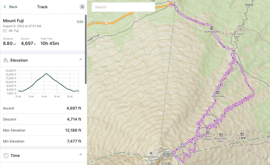
The climbing season for Mt. Fuji is 3 months short because of the extreme weather. There are 4 paths to the top and we chose the easiest of the bunch, the Yoshida Trail. It’s considered easier because of the numerous stations (huts) along the way to sell snacks, drinks, and the all important wood branded stamps for the collectible hiking sticks. It is also the only trail that has a separate decent path to allow for one way traffic near the top.
There are 2 strategies to climb Fuji. Because the assent takes between 5-10 hours, the majority of hikers reserve a hut on the mountain to rest or sleep in. These huts are unheated bunk rooms with mats laying shoulder to shoulder. No privacy or much in the way of accommodations. The second option is to “dangan tozan”, or bullet climb. That is going straight through without resting or sleeping. The signs warns not to try it, saying a climber is 3 times more likely to be injured and the majority who attempt don’t make it.
We chose option 2.
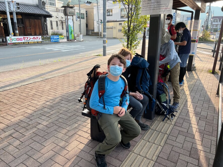
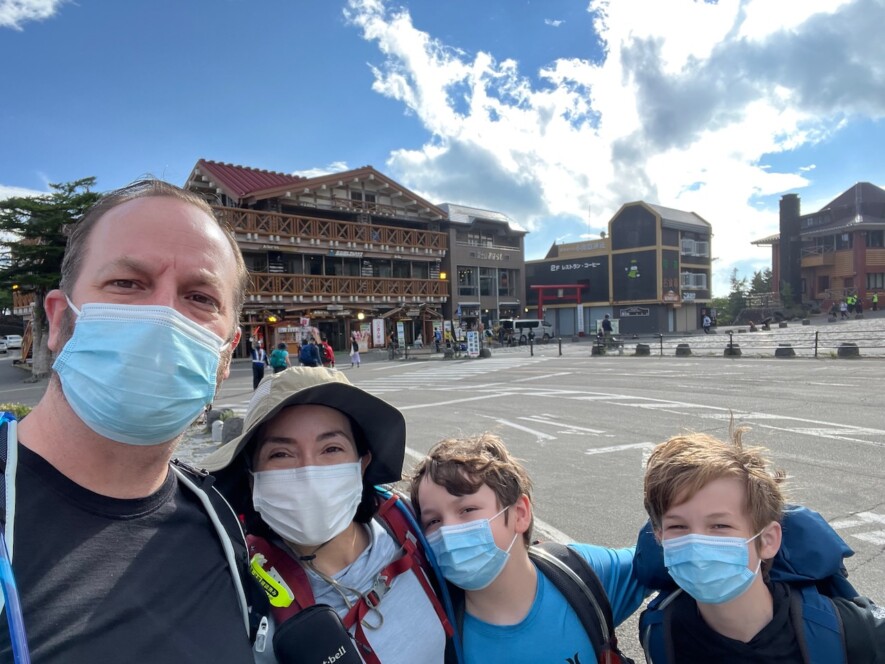
We spent the night prior in the nearby town of Kawaguchiko and grabbed the first bus to the Subaru line 5th station at the Kawaguchiko station. An hour later, we arrived at the 5th station at an elevation of 7,550 feet. We bought some souvenir hiking sticks for the kids, got our Covid check bracelets, good luck engraved wood trinkets for our packs and started hiking.
The stations are numbered the same on all 4 accent routes. Starting with 5 and the summit is 10. There are many un-numbered stations and huts in between, so we never really knew our exact location.
Station 5 to 6 was mainly gentle slopping, forested trail. Coming the opposite way were hundreds of climbers in various stages of haggardness trodding past. Some hobbled, others jogged, and about a dozen were being rescued on donkey back. We decided no matter what, we didn’t want to be rescued by a donkey and suffer that shame.
At station 6, a park ranger click us in on her held-held counter and asked if were spending the night. “Bullet climb!” was my reply. She reminded us the last bus off the mountain would depart at 6:40pm. It was 8am, no problem.
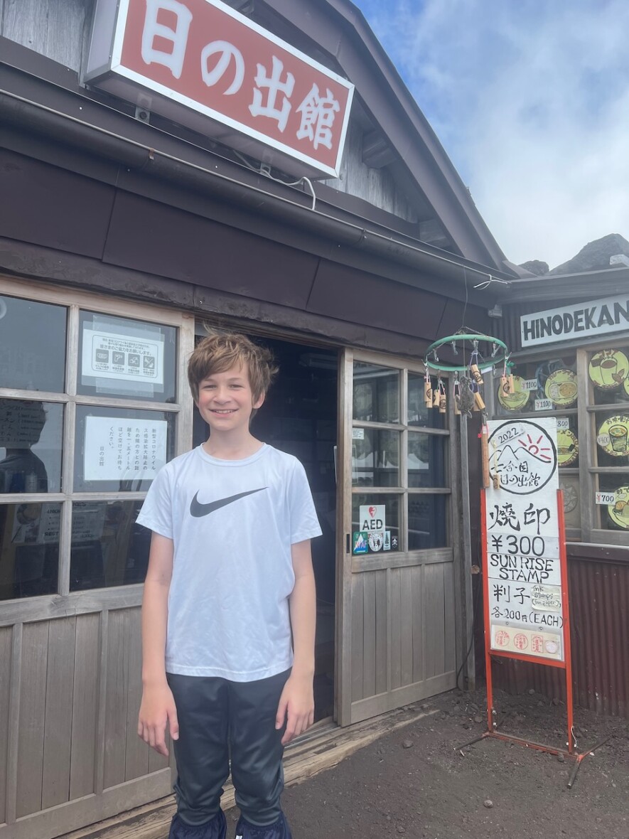
Heading to 7, the terrain changed. We were beyond the tree line and zig zagging up the steep trail. The air was thinning and we had to stop to catch our breath often. After stopping at a few huts, we realized that multiple $3 and $5 stamps were going to start adding up!
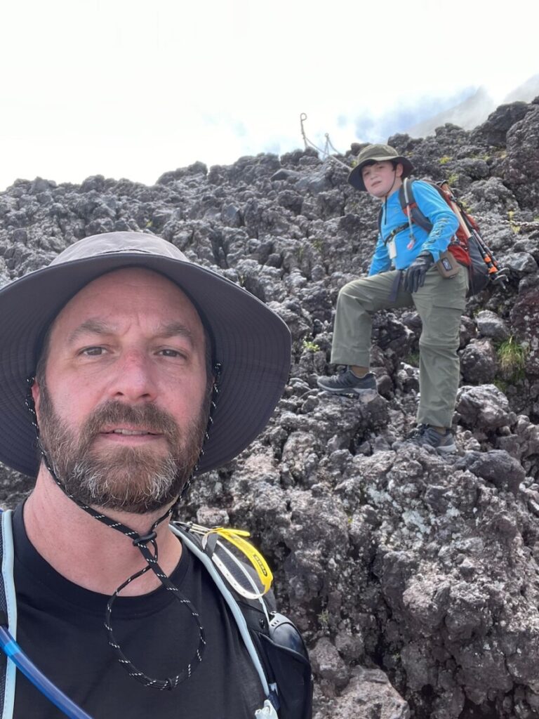
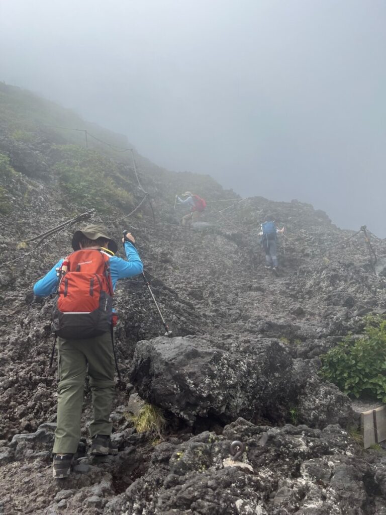
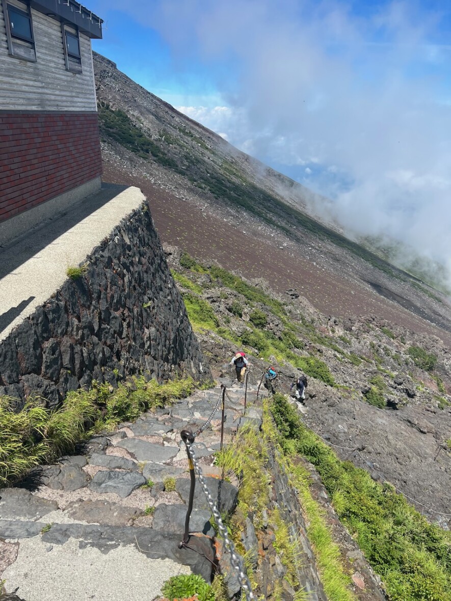
As soon as we passed a random hut, things took a very different turn. “Uh oh” was the first thing I muttered when I saw our trail was now jagged lava rock with metal chains to keep us on path. Not what I was expecting. This was supposed to be the “easy” trail with millions of visitors. I had a sneaking suspicion many visitors don’t actually climb this thing to the top.
The air got thinner. Temperature dropped. Out of breath. Dizzy. Some tears from the kids. Prodding from the parents. Step after step. Stop. Breathe. Repeat. Next hut. It was station 7 and the sign said 5 hours more to the summit. More sobbing from the children.
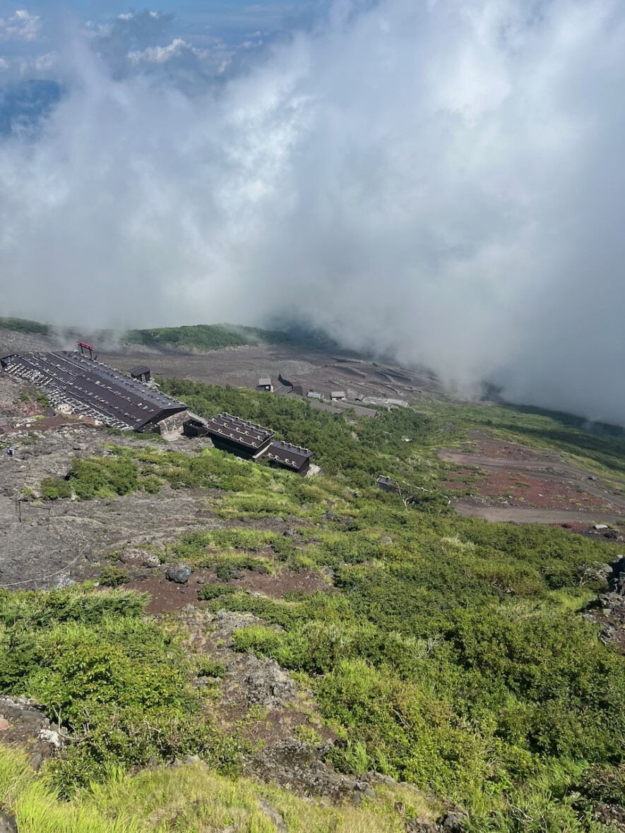
The clouds briefly moved off and we could see to the summit. The trail rose over our heads, zig zagging up to the top. Along the way I could see the huts, and from our angle they looked stacked on top of each other. “See, that’s the whole trail. This isn’t too bad”, I cheerfully told the family. Onward and upward.
Those huts took hours to reach. To stay on schedule we pushed on. At station 8 the clouds moved in again and the temperature dropped to nearly freezing. The wind picked up. It started to rain. We pulled on our fleeces, rain jackets, hats, gloves, put on the pack covers, and climbed on.
We pushed past hut 8 after a brief stop. The sign said 90 minutes to the top. We promised the kids hot cocoa and snacks at station 9. The next hut was in sight, just a dozen switchbacks to go. We climbed the steps, walked up to the window, and the sign said, “Station 8 1/2”. Zachary broke down. His sole crushed. I cajoled him to keep going, station 9!
Station 9 was a pile of lumber. An old hut that must have been crushed by a landslide. We kept going.
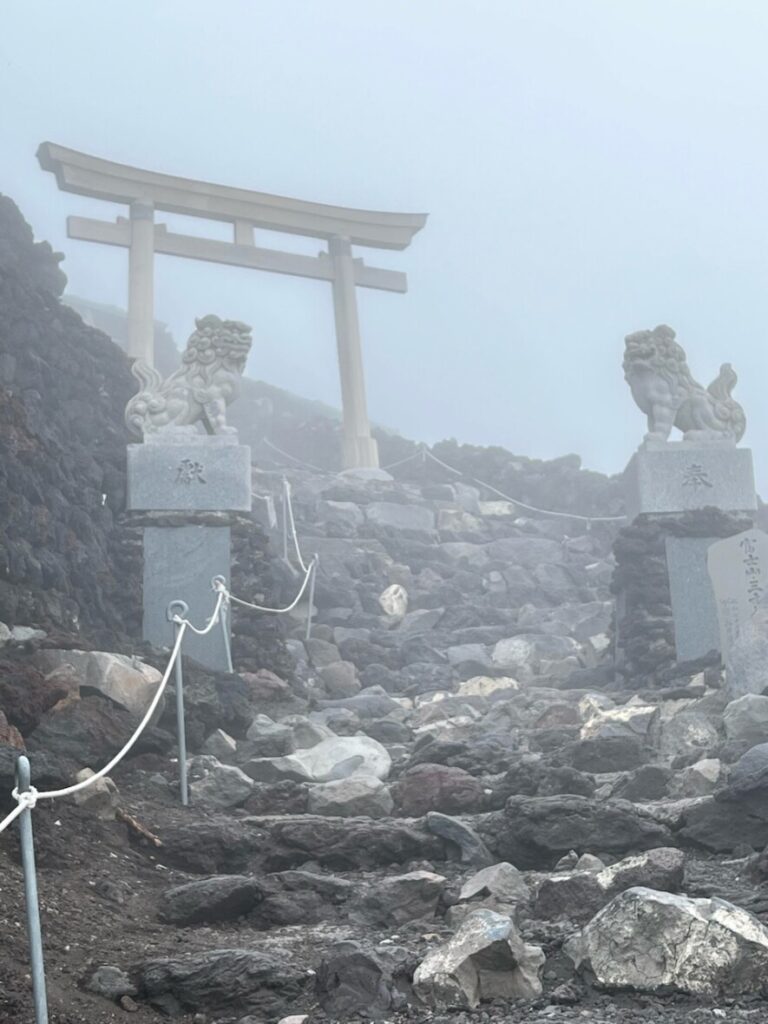
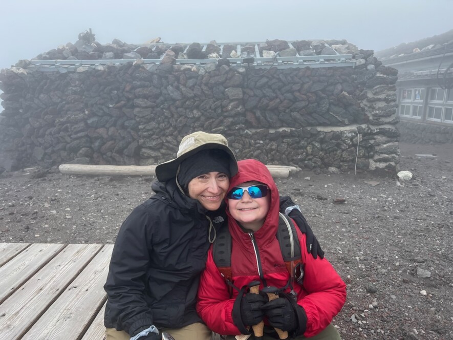
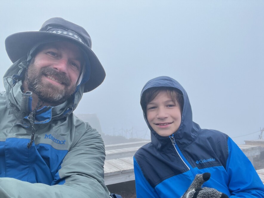
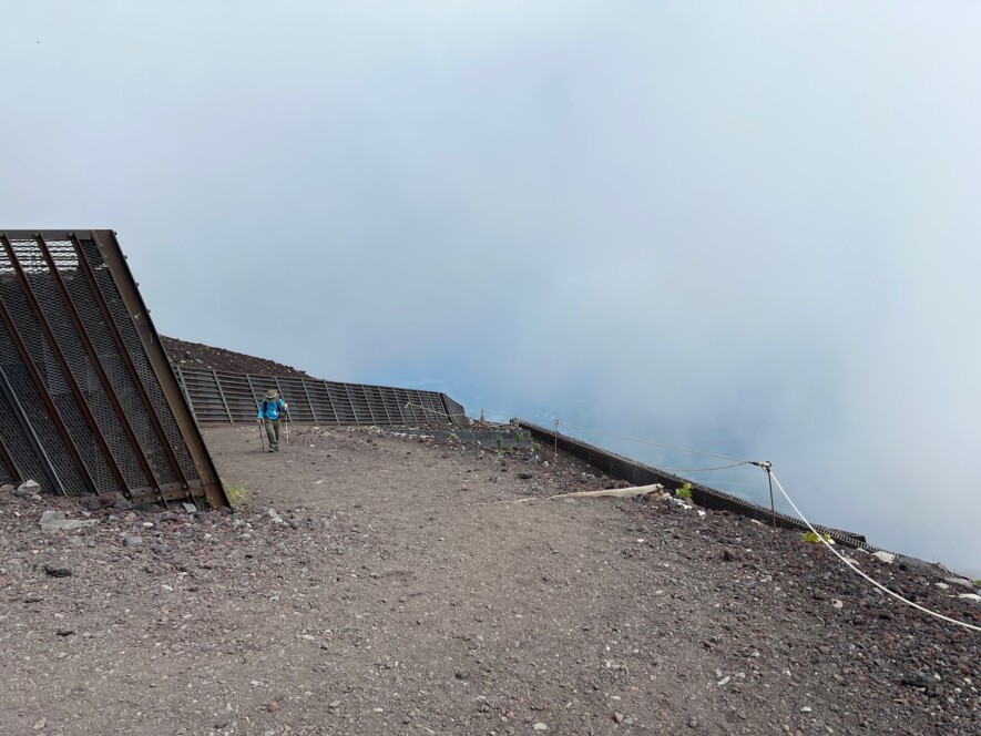
The rest of the way up was a foggy haze from lack of oxygen and utter exhaustion. Another hour ticked by. We summited. There was only a couple of people there. Hut 10 was boarded up, closed. The sign was in Japanese, we had no idea what it said. Nearly 3pm, we were out of time. We used the coin-op bathroom and found the decent path.
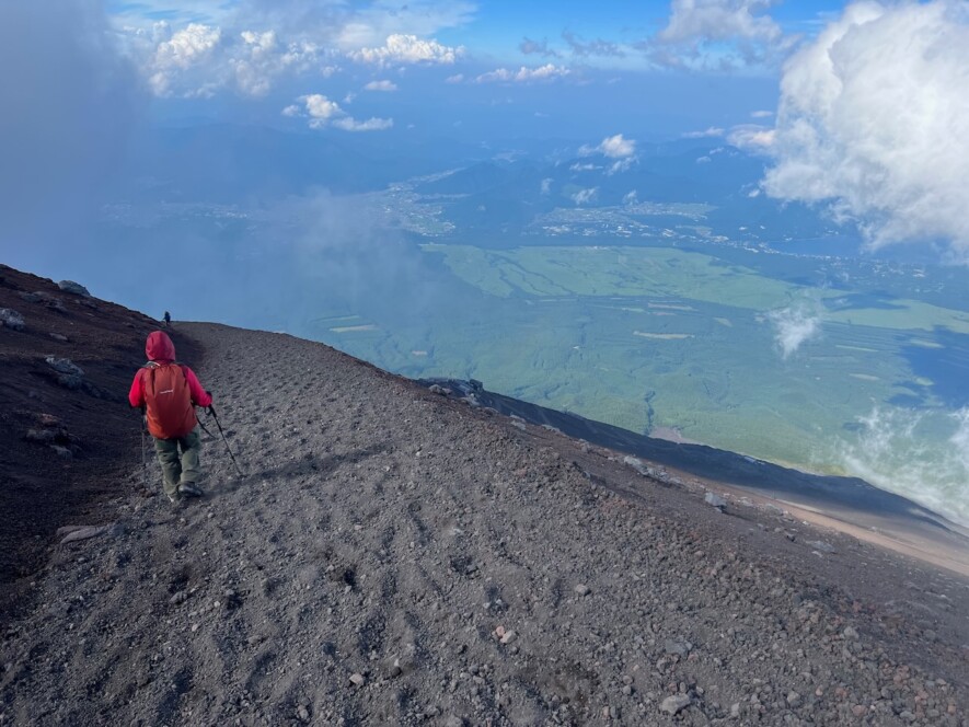
Everyone says the decent is worse than the climb. I thought they were crazy. Turns out there’s some truth to it. The decent is a 30-35 degree slope of ankle deep loose lava gravel. It was like skiing on ball bearings. Step, slide, catch balance with hiking poles. Thigh muscles burned. Legs were getting wobbly. It was miserable.
Delicia and Jack made much better time and soon disappeared down the slope. Zach and I are stuck with the short-step-shuffle on jello legs. An hour went by and the sign said 2 more hours down. Checking my watch I saw the bus would depart in 90 minutes. Uh oh.
Mustering all the energy we could, we pushed through and headed down, down, and further down. Sliding, falling, and looking over the edges to seemly hundreds of switchback to go. No time for breaks. An hour to go and my water ran out. 100 ounces gone. I borrowed some from Zach as he muttered, “I want a donkey ride”.
We found the last switchback and were on the path to station 6. We finally saw the park ranger and she looked at her watch, tapping. I asked, “Do you think we can make it?”. She swung her arms as if running a sprint and pointed us down the trail. “Only if we run?”…. great. We pushed on, back into the forest.
The sun dropped out of sight. 30 minutes later we emerged into the 5th station parking lot just as our bus rolled in. I had enough time to jam 400 yen ($4) into a vending machine for some needed water and we collapsed onto the bus. We had done the dangan tozan. 10 hours, 45 minutes.
1 comment
Yikes! Kamakazi Klimbers. Glad you made it.